June 8 - June 10: Yunnan, China
The Tiger Leaping Gorge (Part II)
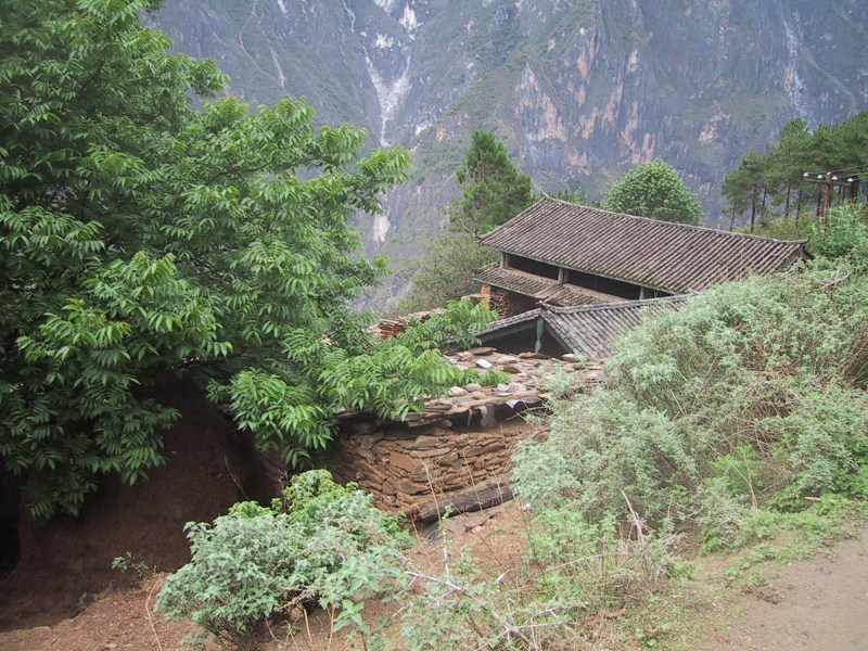
Tina's was a great place to stay! She was extremely nice and the
accomodations were better than expected on a mountain trail. The food
was hearty and tasty! We even had hot showers the night we
arrived. They have a system all rigged up for showers. The shower is a
big concrete box set into the side of the mauntain. When it's time to
shower, they boil water in their wood-burning stove and put the water
in a pail. They put one pail of hot water and one pail of cold water
above the shower. Then they put tubing in the pails, run the tubing
into the shower, and with a little valve thing inside the shower you
could can the flow of water that runs down because of
gravity. Ingenious!
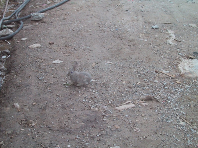
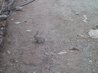
| A cute bunny came to say
goodbye to us before we left on our hike. |
 |
 |
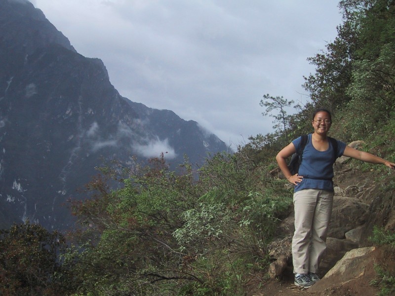
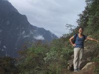
Nancy clearly didn't get enough sleep ... |
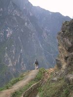
| What a beautiful morning!
Here we are at about 8 am after a half an hour hiking our
way up the mountain after bidding a fond farewell to Tina
and her Guesthouse. |
 |
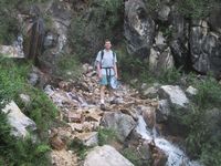 |
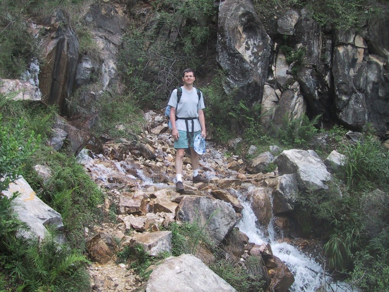
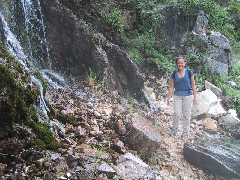
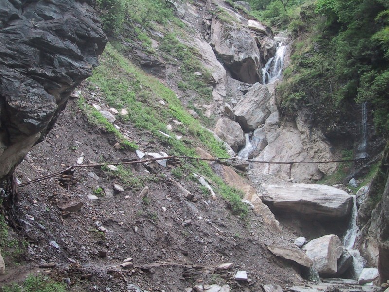
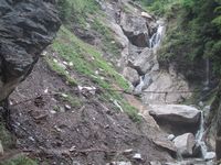
Here's another slippery waterfall we had
to cross, this time with no plank to walk across. But it
was shallow and Bryan stopped in the middle for a photo. |
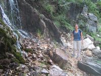
| Nancy's about to make her
way across. Careful, Nan! |
 |
 |
Here you can get a glimpse of the
precipice just a few steps downstream from the crossing.
One small slip could be disasterous! |
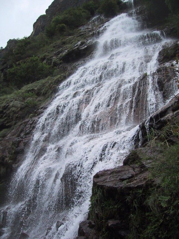
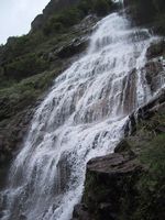
| Of course we made it
across without a hitch, and as we turned a corner we came
face to face with a really spectacular waterfall. |
 |
 |
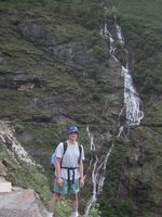 |
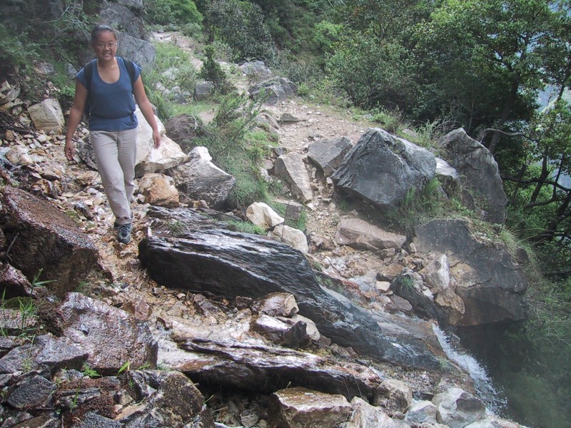
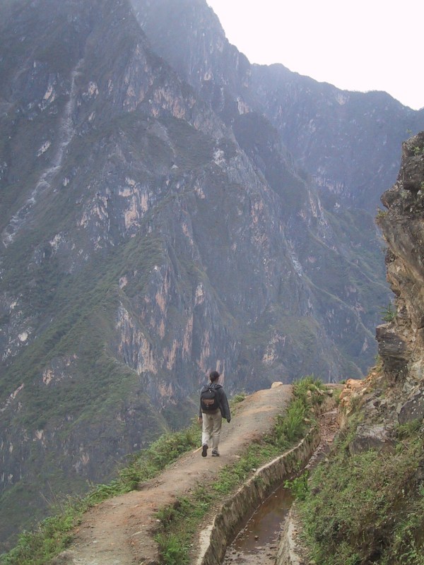
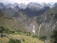
Continuing on the trail wrapped around
again as it followed the countour of the mountain range
and we had a good look at the waterfall from a distance. |
 |
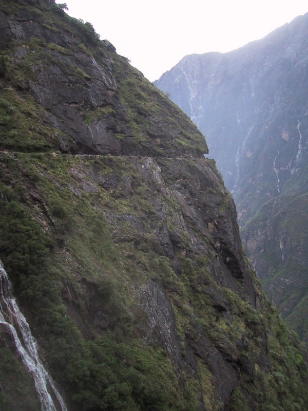
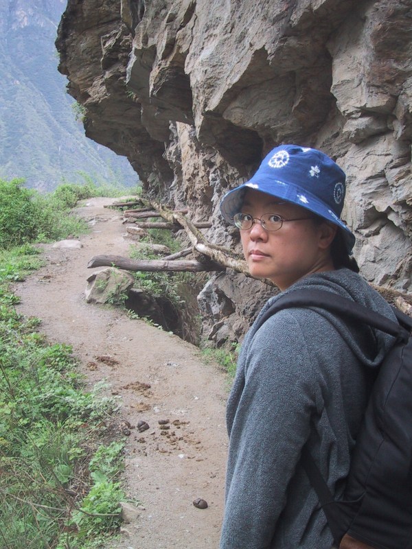
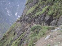
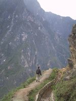
It's lucky that someone
carved out the trail that you see here, otherwise it
would have been considerably more difficult to make our
way around the mountain. |
 |
 |
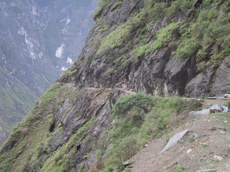
If you look closely you can see Nancy
making her way down the trail. |
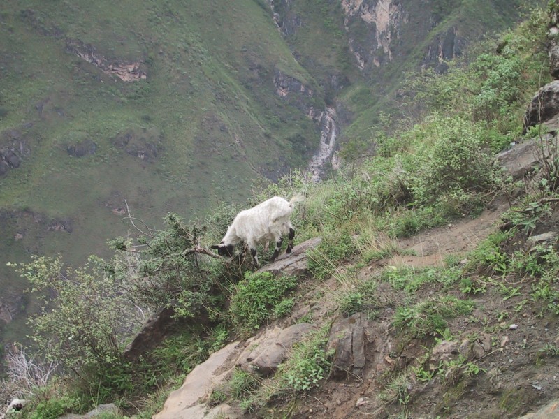
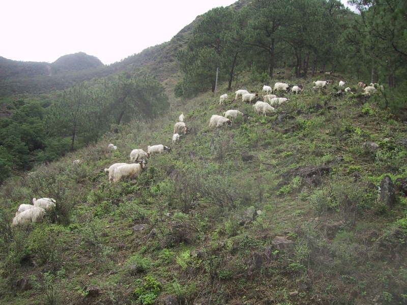
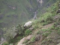
| These mountain goats
didn't bother staying on the trail. |
 |
 |
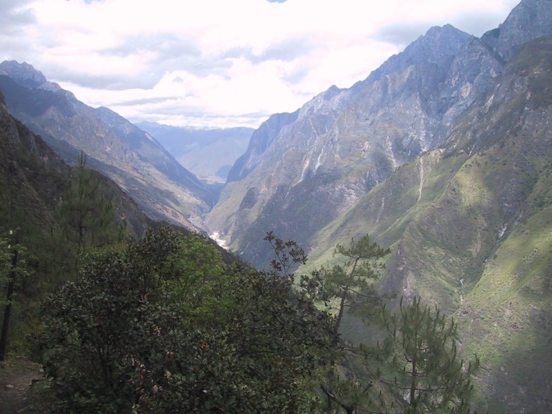
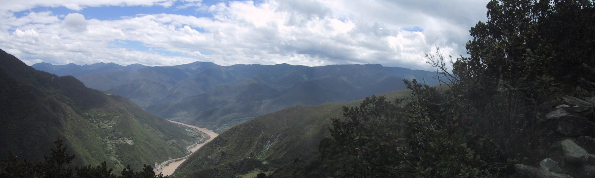
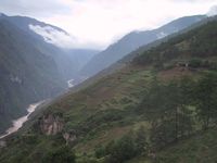
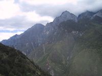
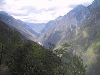
The river is once again far below us. |
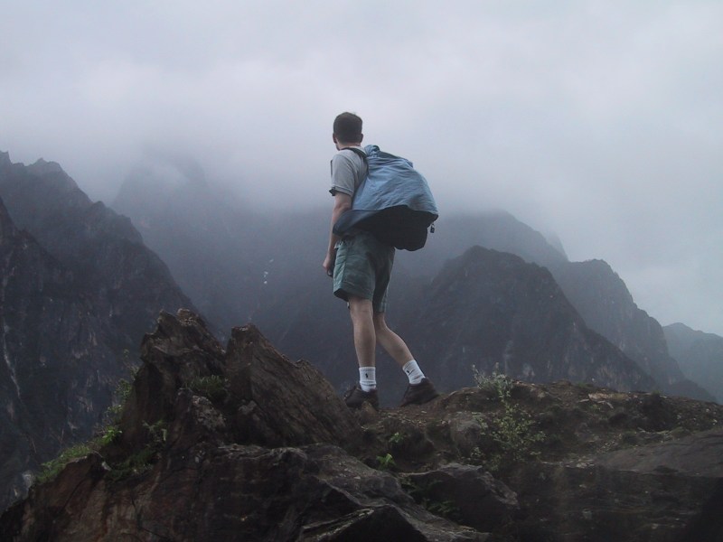
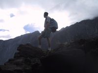
| Bryan scampered up onto a
rock to get a better look at the mountains. Some fog was
just starting to roll in over the peaks. |
 |
 |
 |
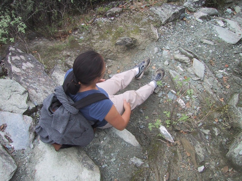
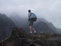
There goes Nancy ... |
| ... about to step off the
edge of the world. |
 |
 |
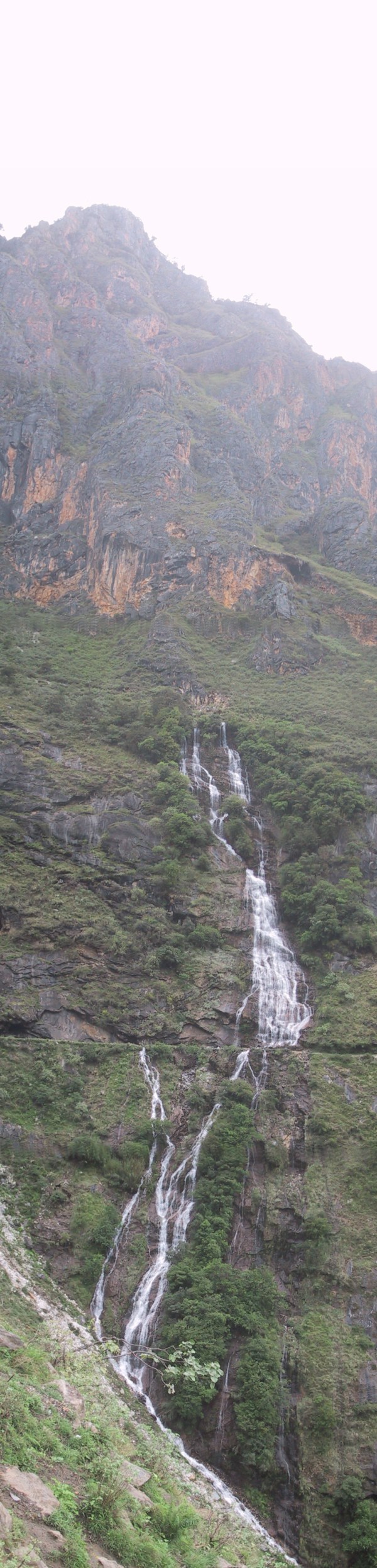
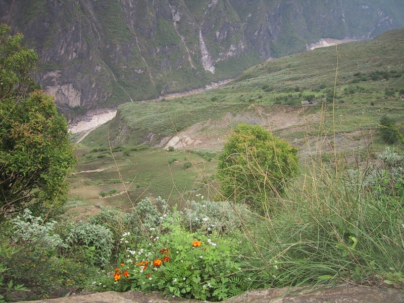
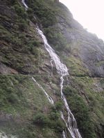
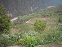
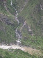
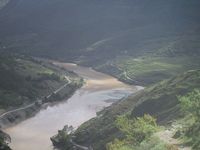
Throughout the hike, streams and
waterfalls were abundant. Here, the farmers of a nearby
village have made the best use of the situation by
rigging up bamboo piping to catch the water and lead it
all the way down to their field. You can see the
beginning of the pipe in the center of the photo; the
water is collected from a small waterfall at the right
and is carried, with the help of gravity, towards the
left. |
| The pipe is in front of
Nancy, following its way around the mountain face. It
became narrower and narrower as water was lost at various
cracks and junctures ... |
 |
 |
 |
... but enough water made it through at
the end to supply a nice steady flow to the small village
below. |
| The sun is starting to
shine through the fog. |
 |
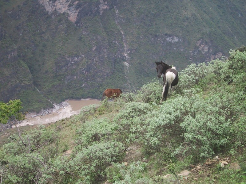
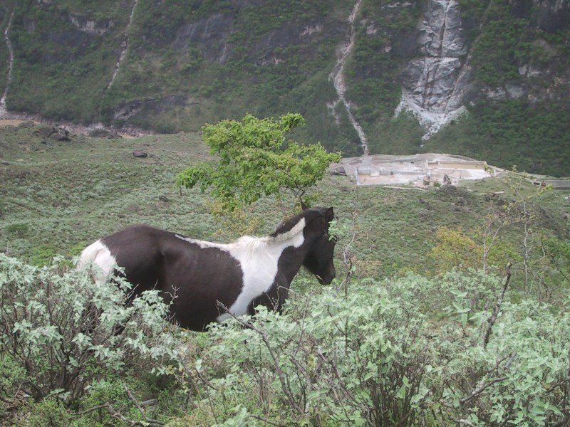
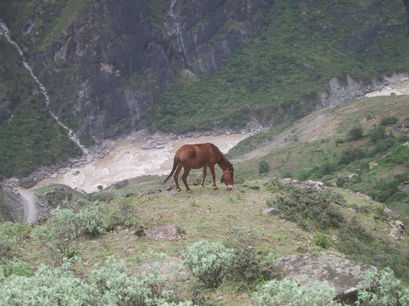
There were horses up on the mountain slope,
too, grazily contently amidst the peace and tranquility.
 |
The sun has finally broken all the way
through. The clouds cleared and by noon or so, the sky
was bright and blue. |
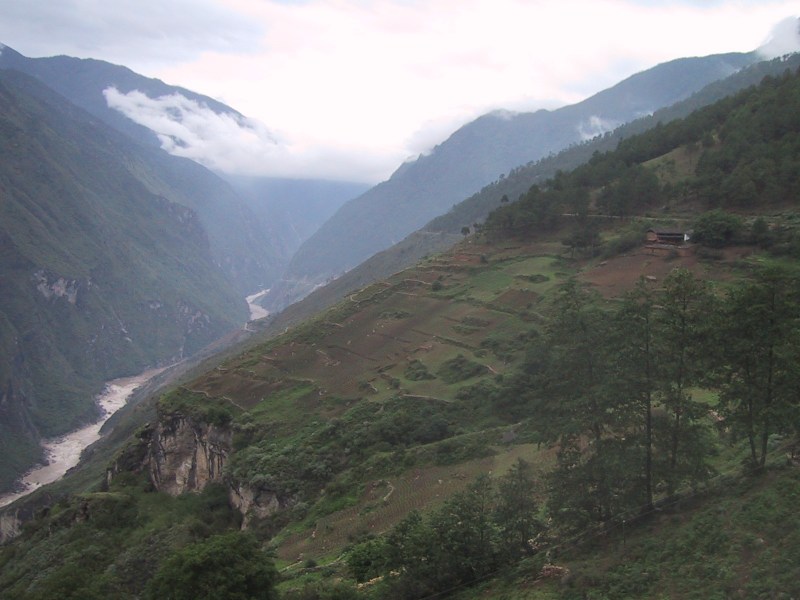
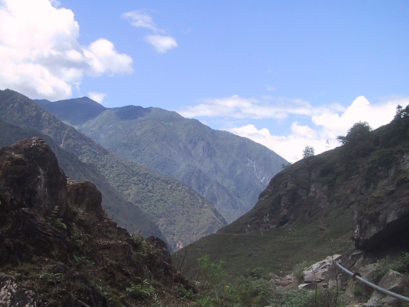
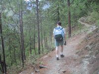
Here we are passing through a pine forest. The best part about
this hike (which covered approximately 15 kilometers this second
day with multiple ascents and descents of 1,000 feet or more over
the course of 11 hours) was the various conditions that we
experienced. At some points the wind blew fiercly and the skies
were foggy, and we felt like we were all alone high up on a
mountain pass. At some points it was very hot and sunny;
sometimes we passed through pine forests, with the heavy scent of
alpine pine trees; at other times, we passed through quiet bamboo
forests, while at other times, the landscape was rocky and
barren. Sometimes the path was narrow, sometimes wide, sometimes
we were ascending on twisty switchbacks up sheer faces of rock,
and sometimes we were descending wide dirt paths. We experienced
such a wide range of conditions, smells, sights, sounds, and
moods over the 11 hours - it was absolutely fantastic! But
always, there was the next step to take, either up, down, or
straight ahead, as our legs became more tired, or backpacks
heavier, and the day wore on and on.
 |
 |
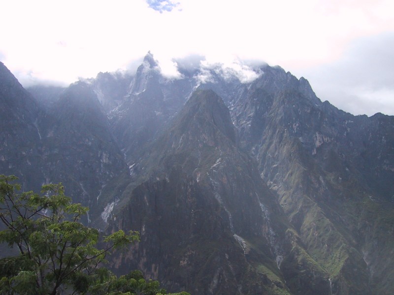
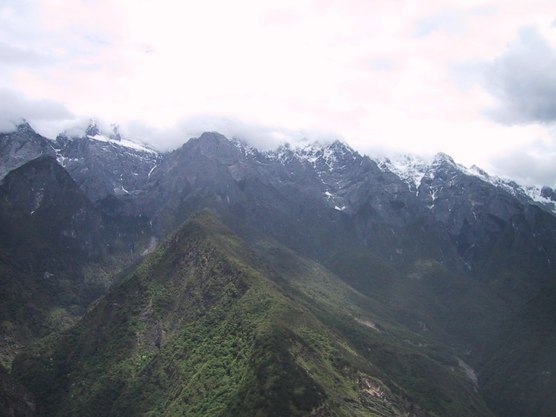
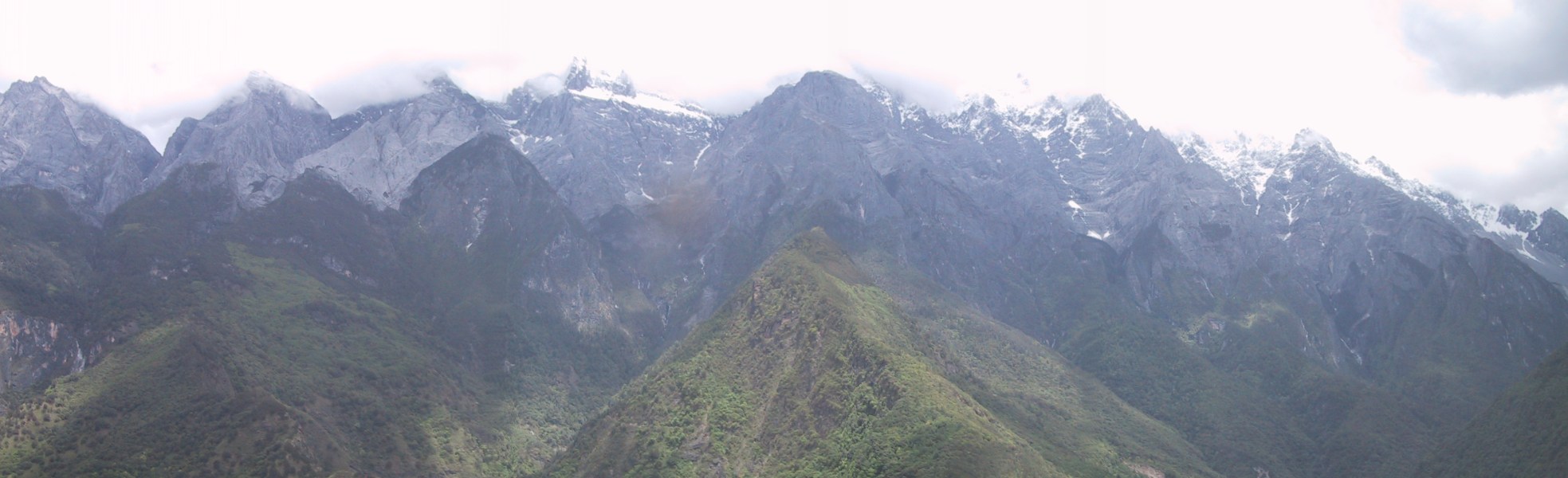
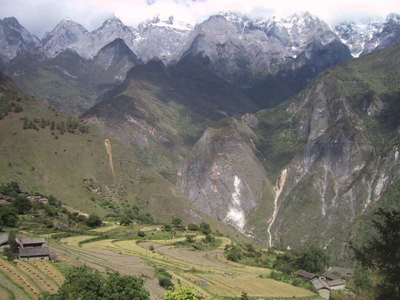
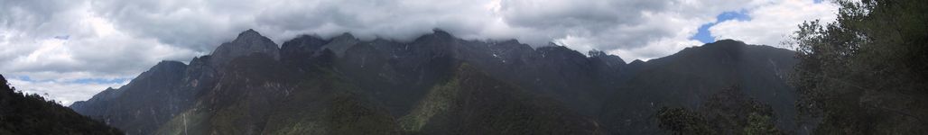
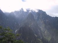
| As the clouds dissipated
we got our first glimpse of snow on the higher peaks. |
 |

Gorgeous! Tiger Leaping Gorge-ous!
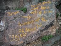 |
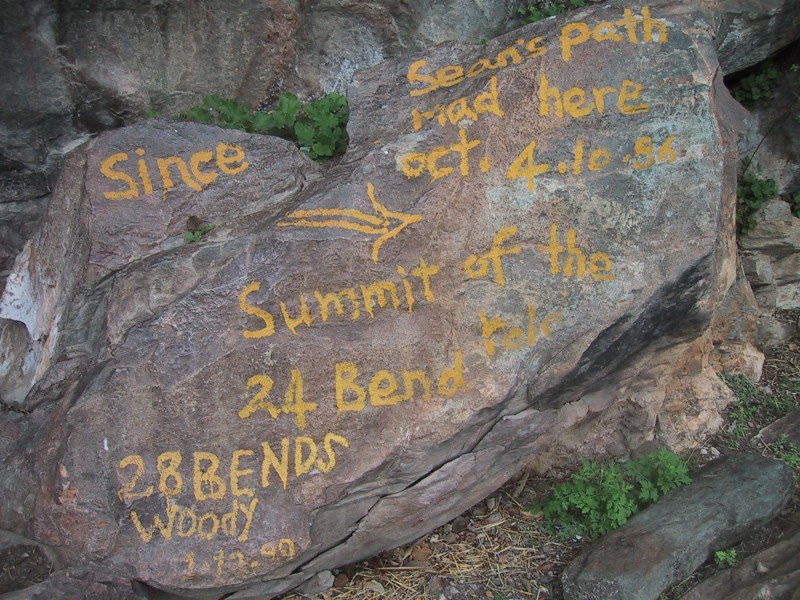
We were happy when we finally made it to
this rock. This rock marked the highest point of the hike
- we felt like we had been climbing forever and were
looking forward to some movement downwards. Next up: the
28 bends on the way down. |
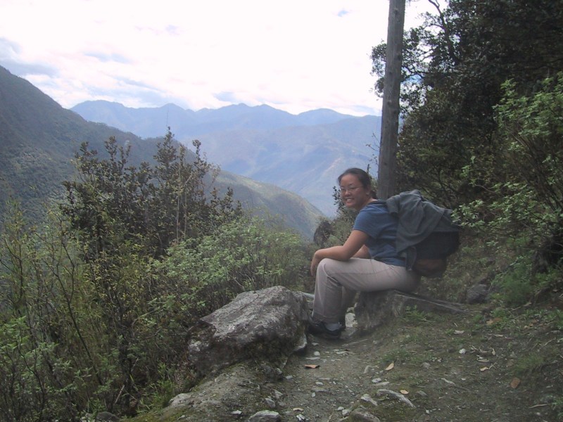
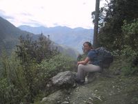
| Nancy takes a well-deserved
break. |
 |
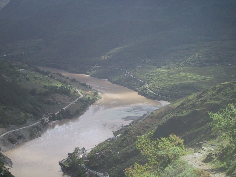
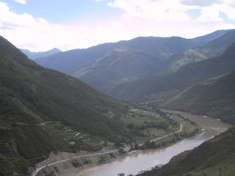
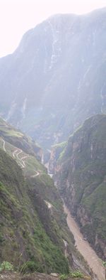
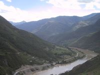
Somewhere down there is the town of
Qiaotou, and a bus to take us back to Lijiang.
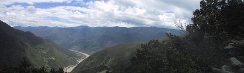
This is the best photo of the whole trip. You
owe it to yourself to click on this to get a larger view. Go
ahead!
Well, we thought that once we reached the rock at the summit,
we'd have an easy hour descending down into Qiaotou. After one
false alarm - a village that looked like it might be Qiaotou but
wasn't - the path just kept going on and on. Nearly three hours
later, we were wondering whether Qiaotou had packed up and moved
somewhere else.
 |
 |
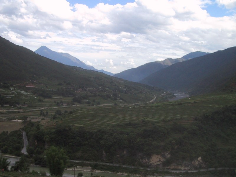
Ah. We finally made it to Qiaotou. The trail led into a high
part of town, and turned into a gravel road that wound its way
down, past homes, schools, and small shops. A couple of popsicles
helped boost our spirit but we were still a good 45 minute walk
from the center of Qiaotou and the last bus back to Lijiang was
leaving in half an hour. We started walking faster but things
didn't look good for us. A few minutes later, our prayers were
answered when the only car we'd seen on the road thus far - a
little "bread box" minvan - pulled over and asked us if
we needed a ride into town. Yes!!! OK, so we cheated on the last
kilometer, but at least we can say that we hitchhiked in China.
We also made it to the bus station with just a few minutes to
spare, and were back in Lijiang by evening.
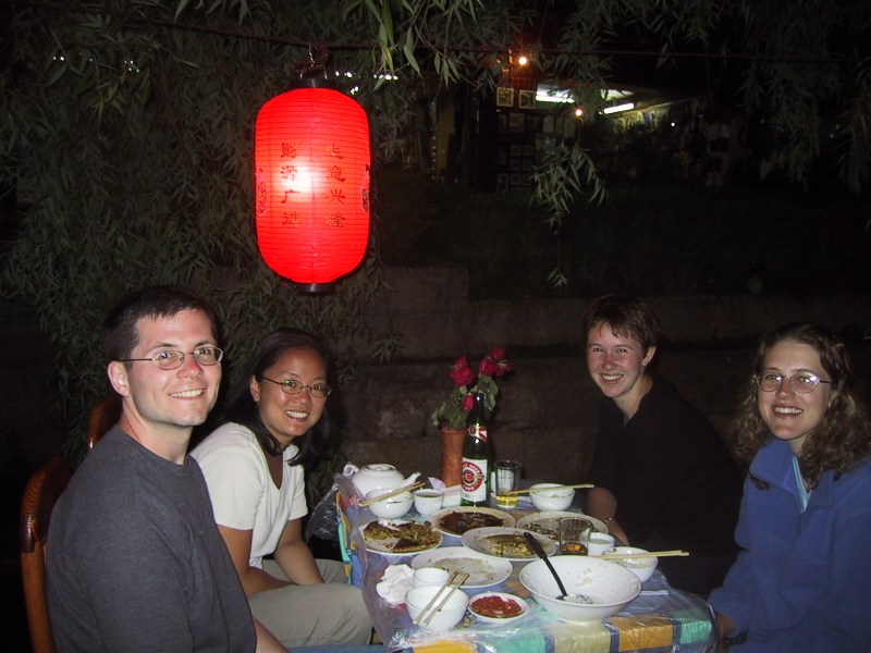
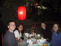
| We met up with some other
hikers whom had been on the trail at the same time as we
had (although we hadn't seen them since leaving Tina's in
the morning). They were two Canadian students who were
travelling in China for an extended period. We had a
great dinner at our favorite Naxi family restaurant in
Lijiang. Even with one vegetarian in the party, we found
fantastic dishes to order. |
 |
The next day we were debating hopping on a bus to Dali,
thinking we had nothing more to do in Lijiang, when we ran into
another pair of hikers whom had been on the bus on the way to the
gorge, but who had quickly outdistanced us on day one of the
hike. They told us their unfortunate story of becoming separated
- as the woman went ahead of the man, who had stopped to take
some photos, she accidentally went the wrong way at a fork in the
path. He came along a few minutes later and took the correct
path, and from that point on they were each trying to catch up to
the other. She ended up on the "low road", which is a
gravel road lower down the mountain, while he stayed on the
"high path" (which was the one we had taken).
Eventually they were reunited when they each arrived at Qiaotou
six hours later. What an unfortunate way to spend the hike -
worried and on the lookout for your partner!
They were interested in something that they had read in the
Lonely Planet travel guide concerning a cable car ride up to a
meadow high up the mountain where it was possible to rent and
ride horses. We decided to extend our stay in Lijiang one more
day and go along with them. Unfortunately, the Lonely Planet's
description of this outing left a lot to be desired. We hired a
taxi driver to take us there but we ended up at the wrong place.
The more we read the Lonely Planet's description, the less sure
we were about what it really meant. Finally we came to the
conclusion that the Lonely Planet had mixed up two different day
trips: one involves a cable car up the mountain to a vista point.
The other is some 25 kilometers away, over twisty mountain roads,
and is an alpine meadow where horses indeed can be rented. But
they are not one and the same place, as seemed to be suggested by
the travel book, and after having spent over an hour trying to
figure out how to get to this nonexistent single destination, we
finally realized what the confusion was all about. Our taxi
driver told us that the meadow in question was a good two hours
drive away, and wouldn't give us enough time to really enjoy the
sight, so we opted to try out the other half of what we were led
to believe was a single place: the cable car up to the highest
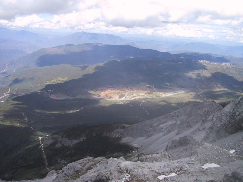
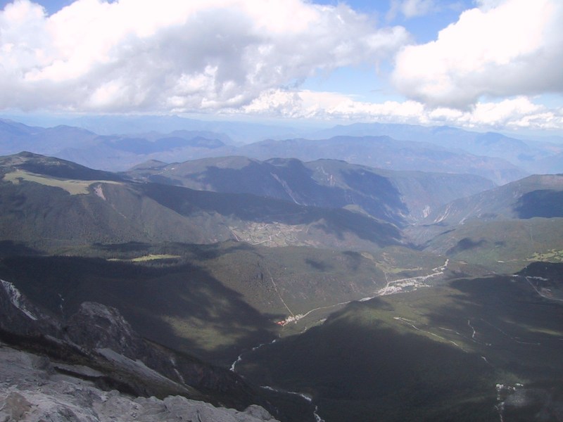
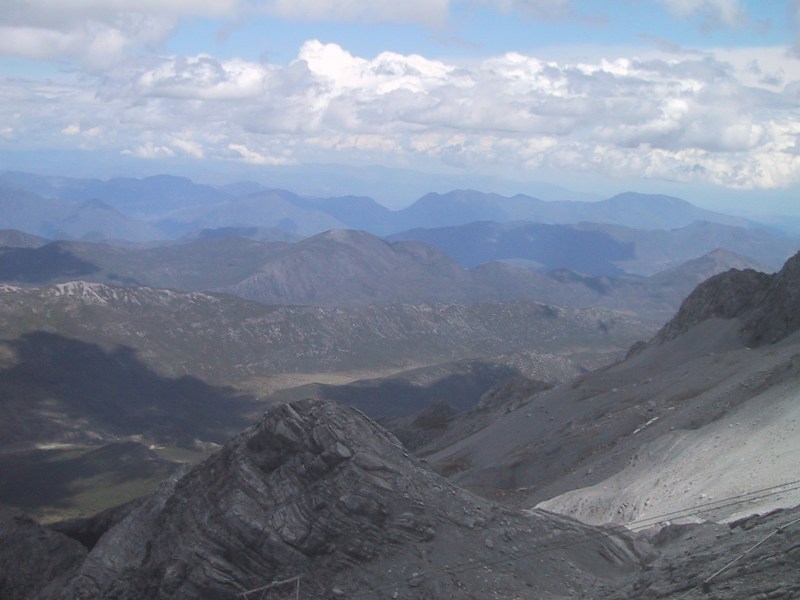
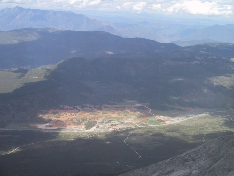
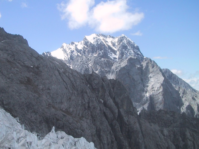
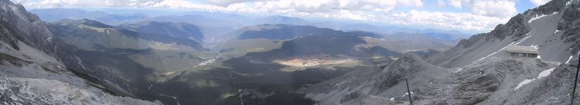
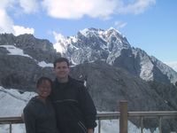
point on the Jade Snow Mountain. The residents in the area can
enjoy the snow capped peaks of these mountains year-round.
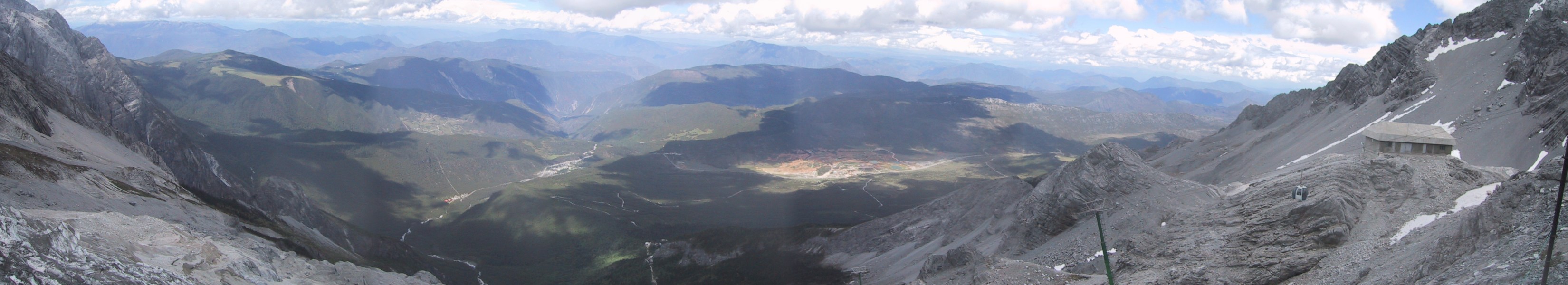
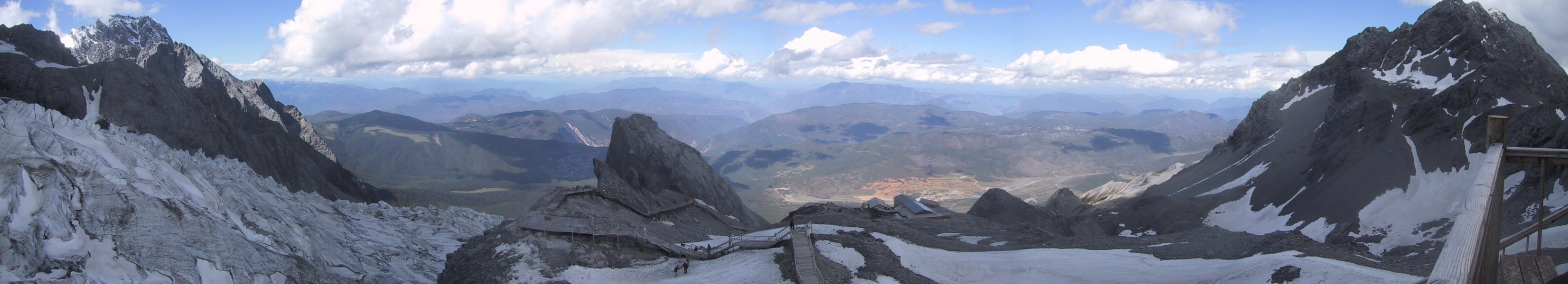
The cable car starts at the bottom (naturally) and takes its
passengers up to a station about 14,500 feet up the mountain.
Here are some photos from the station.
 |
 |
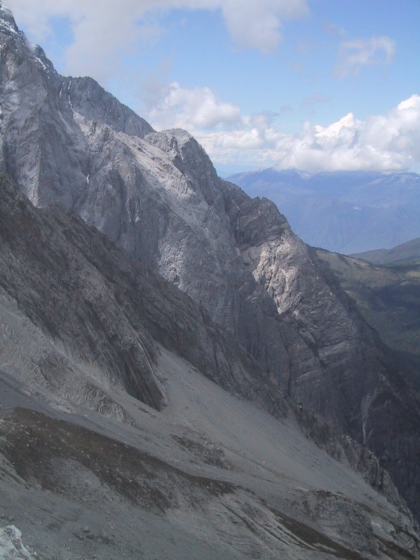
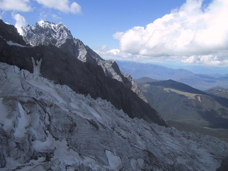
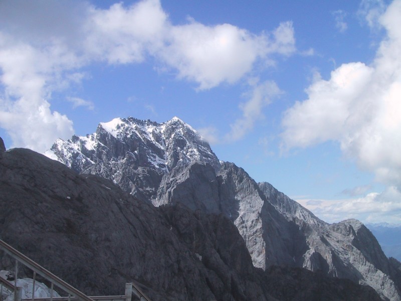
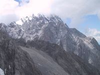
At this altitude the temperature is just
below freezing and there is snow and ice everywhere. |
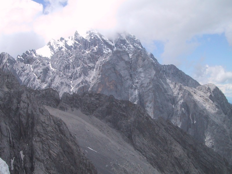
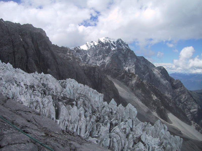
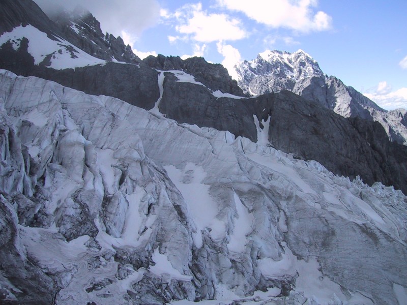
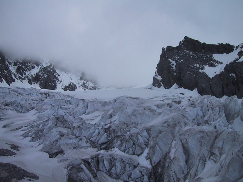
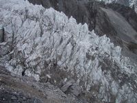
| There are actually
permanent glaciers near the top of the mountain. At first
these looked just like sharp rock formations, but we soon
learned that they are glaciers - frozen mountains of ice. |
 |
 |
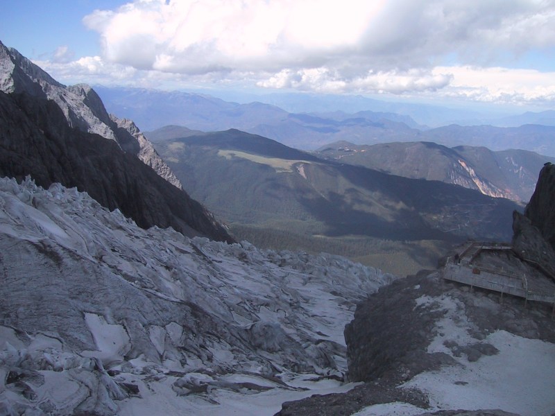
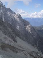
From the station, a wooden plank walkway extended up the
mountain for another 600 or 700 feet. The walk up the walkway was
very hard - at this altitude you very easily become out-of-breath
and dizzy. We had to stop every 50 to 100 feet for a few minutes
to rest before continuing on. They actually rent out air bags
that you pump up at the base of the mountain and take up to the
top. Should the air seem too thin you can breathe the air that
came from the mountain below. Eventually we made it to the
platform at the end of the walkway, which is the highest you are
allowed to go.
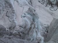 |
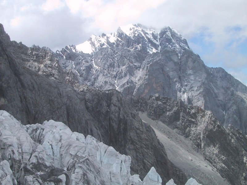
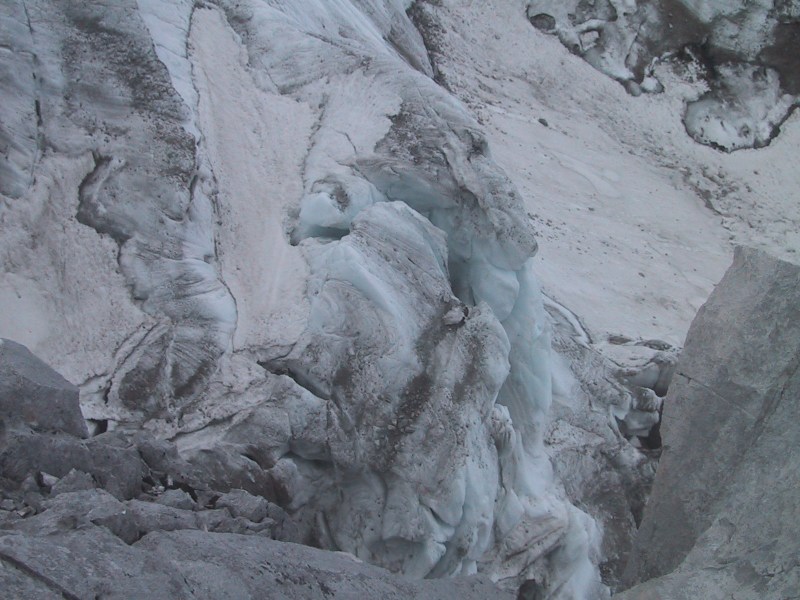
Here you can see definitive proof that
they really were glaciers - the blue-green tint is caused
by light being reflected around inside the ice, and
emerging with a blue tint due to the absorption of other
spectra of light by particles in the ice. |
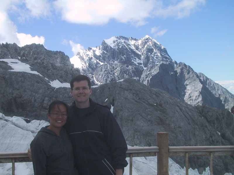
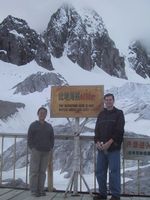
This was Bryan's twenty-ninth birthday. Happy
Birthday, Bryan!
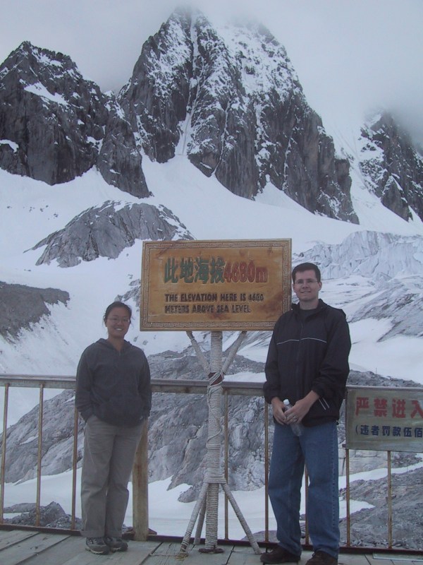
| On Bryan's 29th birthday,
he ascended to the highest point altitude that he's ever
been on land. There's the proof - 4680 meters, or 15,354
feet. Brr!! It was frigid! It's not often we hang around
outside in below freezing temperatures in just a pair of
pants and a thin sweatshirt. Where's that down overcoat! |
 |

 |
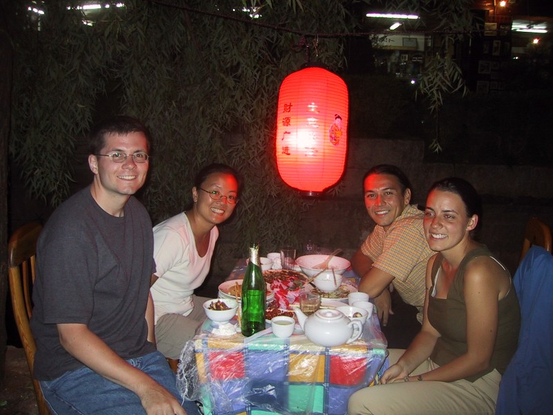
Back in Lijiang, Bryan celebrated his
birthday with two cold bottles of Carlsberg beer ... |
| ... and some fresh lychees
... yum! |
 |
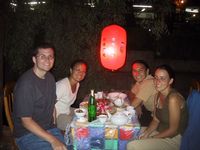 |
That evening we had dinner with our new
friends at the same Naxi restaurant - even the same
table! We ate at that restaurant three times while we
were in Lijiang - it was that good! They had an amazing
dish of simply scrambled eggs with squash blossoms!!
Fantastic! If you follow food fads, squash blossoms were
the new "in" food before we left. They've
probably been using them to cook for hundreds of years
here in Yunnan. |
That evening we stayed at a nice, cheap Naxi family hotel, with hot water
available for a shower when we wanted it! The family running the hotel was
great and so we are providing their info here for anyone who would like to
stay there on their next trip to Lijiang:
ChaMa Naxi Family Guest House
Jishan Lane #9, Xinyi St.
Lijiang, Yunnan, China
0888-5120351
After a long, nearly 9 hour bus ride, we arrived in Kunming
with just enough time to contact our previous travel agent to
arrange air transportation back home to Beijing. It is
exceedingly convenient to fly in China as plane tickets can be
purchased at the time of departure, provided that there are seats
available.
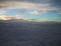
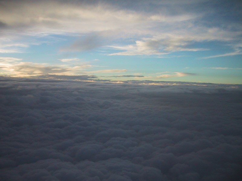
Somewhere underneath those clouds is Lijiang, the Tiger
Leaping Gorge, and all of incredible Yunnan ... we bade a fond
farewell to this wonderful part of China from the seat of a 747
on the way back to Beijing.